RED-LINE BOUNDARY PLAN
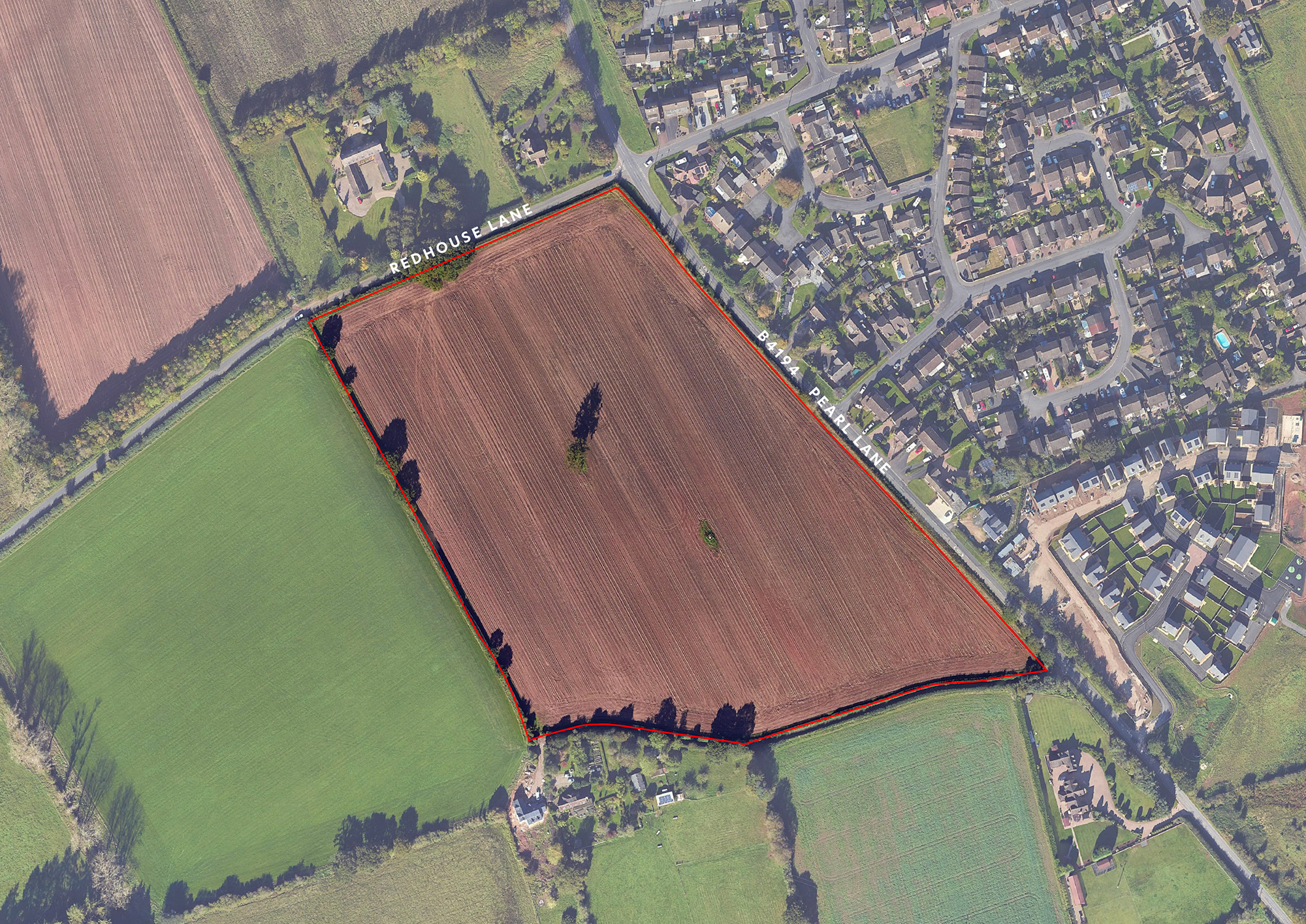
The Site is currently accessed via a field gate on Redhouse Lane. A public right of way (PROW) runs within the Site along its western boundary and another PROW runs across the south-eastern corner of the of the Site.
The Site slopes gently from west to east, with the lowest part adjacent to Pearl Lane. There are hedgerows surrounding the Site, with a group of trees on the northern boundary and a group in the south-eastern corner. A single tree is located within the centre of the Site.
The site falls within both Wyre Forest and Malvern Hills District Councils. The adopted Development Plan for Malvern Hills District Council is the South Worcestershire Development Plan (February 2016), which was prepared by Malvern Hills, Worcester and Wychavon Councils. The adopted Development Plan for Wyre Forest District Council is the Wyre Forest Local Plan, adopted in April 2022.
Currently the South Worcestershire Development Plan is under review and a draft plan has been submitted to the Secretary of State for examination by an independent Inspector.
South Worcestershire currently have a housing shortfall and can only demonstrate 3.83 years supply as of 1st April 2024.
As set out in the two Development Plans, the site is located adjacent to the existing settlement boundary of Astley Cross and as such is in the open countryside but not within an area of Green Belt. The development of the Site as proposed would provide a much needed contribution to the housing requirements of Malvern Hills, whilst being in a sustainable location on the edge of Stourport, in accordance with Wyre Forest’s Settlement Hierarchy.